What clearer evidence could we have had of the different formation of these rocks, and of the long interval which separated their formation, had we actually seen then emerging from the deep... The mind seemed to grow giddy by looking so far into the abyss of time.—John Playfair, upon seeing Siccar Point*

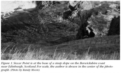
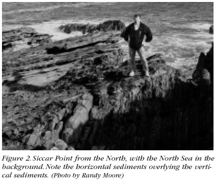
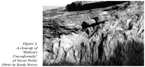
During June 1788, Scottish geologist James Hutton — along with mathematician John Playfair and chemist James Hall — visited Siccar Point, which is arguably the most important geological site in the world (Figure 1). Siccar Point is a rocky promontory "washed bare by the sea" on the Berwickshire coast near Scotland's border with England. Geologically speaking, Siccar Point is an unconformity — a term coined in 1805 by geologist Robert Jameson to describe a surface at which two separate sets of rocks formed at different times come into contact. Sediments at the base of Siccar Point are vertical and, because sediments can only form horizontally, Hutton knew that these sediments had been tilted and raised above land by pressure. Erosion had then worn away the above-ground parts of the vertical sediments, after which they were again submerged and covered by new horizontally deposited sediment (Figures 2 and 3). Charles Lyell, who visited Siccar Point with Hall in 1824, used a sketch of the site as the frontispiece of his Manual of Elementary Geology (1855). It is no wonder that Siccar Point is a Scottish National Heritage site.

The vertical sediments at Siccar Point are Silurian greywacke, a gray sedimentary rock formed approximately 425 million years ago when colliding plates created immense pressure that converted the sediment to rock. By about 80 million years later — a period that is more than 10 000 times longer than all of Archbishop Ussher's proposed history of earth — the raised greywacke had eroded and parts were again submerged in the ocean. Erosion of the nearby Caledonian Mountains produced reddish sandstone sediments (Old Red Sandstone of the Devonian) that were deposited horizontally over the vertical greywacke sediments (of the Silurian).When pressure created by moving plates again buckled the sediments, Siccar Point was raised above land for Hutton and others to see. Except for the chiseling by thousands of souvenir-seeking geologists who have visited the site, Siccar Point looks today as it did when it was visited by Hutton and his friends in 1788.
Finding Siccar Point: Although Siccar Point (Coordinate: 55° 55' 55.89" N, 2° 17' 54.74" W) is part of the James Hutton Trail, it is not marked on any of the tourist maps available at Edinburgh hotels. The best way to see Siccar Point is on a tour provided by GeoWalks (http://www.geowalks.demon.co.uk), a small geology-education company owned by Edinburgh geologist Angus Miller. Siccar Point is beautiful from above looking out onto the North Sea. If you choose to go down to the unconformity, be prepared to slide down the steep hill and to be quite exhausted by the time you get back to the top.There is a mold of a small part of Siccar Point on display at the American Museum of Natural History.
* Transactions of the Royal Society of Edinburgh Vol V, Pt III, 1805.
